Drone courses and training
The TSR school teaches what the crew does on site every day. Registration and full terms are on the school site.
COURSE 01
Drone mapping and survey course
A course that teaches from scratch how to turn a drone flight into a measurable, accurate deliverable, from planning the mission on site to an orthophoto and 3D model in the office.
Good to know: this is a professional course in drone-based mapping and measurement. It does not qualify you as a licensed surveyor and does not grant a surveying licence or any official certificate.
Full terms and registration on the school site (Hebrew) (opens in a new window)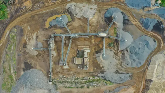
- 8–16teaching hours, by track
- 2professional software tools
- Group or 1:1up to 6 students, or one-to-one
- On sitehands-on planning and flying
Two tracks, choose one
- GROUP
Classroom course
ILS 3,000 + VAT
per student, in a group of up to 6
4 sessions of 4 hours, 16 hours in total
- A small class
- More time for hands-on practice
- Learning from other people's projects
- Personal support after the course ends
- 1:1
One-to-one tuition
ILS 4,500 + VAT
per student, on dates arranged with you
2 sessions of 4 hours, 8 hours in total
- A pace that suits you
- A focus on your type of projects
- Fully flexible dates
- Personal support after the course ends
The price includes study materials, a field card and a completion certificate. It does not include software licences, government fees or travel outside the central region. Your place is secured once a deposit is paid, and cancelling up to 7 days before the first session gives a full refund.
What the course includes
- Full theory: photogrammetry, accuracy and coverage
- Field practice: planning and actually flying
- Hands-on work in Agisoft Metashape and Bentley ContextCapture
- A field card for independent use after the course
- Personal support after the course ends
- A TSR completion certificate (not an official qualification)
What you will be able to do
- Plan a mapping mission: height, GSD, overlap and ground control points
- Fly safely and in line with regulation
- Shoot correctly for orthophotos and 3D models
- Work through Agisoft Metashape from start to finish, and know when Bentley ContextCapture fits
- Check accuracy and produce deliverables for a client
Who it is for: Surveyors and engineers, construction and infrastructure staff, farmers, security personnel and drone pilots who want to go professional. No prior knowledge needed.
COURSE 02
Multirotor flying licence up to 25 kg
Training to operate commercial drones with a take-off weight of up to 25 kg.
It is the common licence for most drone professions: mapping, agriculture, solar and security.
- Exam preparationCivil Aviation Authority written exam
- Flight instructorsProfessional
- Support through certificationTo the licence
What you learn
- Theory: aerodynamics, meteorology, navigation and air law
- Practical training with certified flight instructors
- Full preparation for the written and practical Civil Aviation Authority exams
- Safety procedures, risk management and flight planning
Who it is for: Commercial operators, photography and survey providers, and contractors.
Contact
A question about the courses?
Leave your details and we will come back with focused questions and a quote for your project. Rather talk now? We are on the phone and on WhatsApp.